A Polar Vortex Headed for the US Brings Cold Winds and Low Temperatures
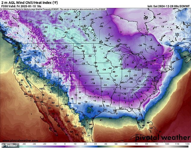
A massive arctic blast is headed for the United States, with the National Weather Service predicting that temperatures will be exceptionally low across much of the country. The cold air is expected to spread from the northern Rockies to the East Coast by New Year’s Day, making January the coldest month in over a decade.
The plunge in temperatures will bring wind chills across the Midwest, with temperatures dipping below zero in at least 30 states. The coldest air of the season is expected to date, with dangerous wind chills in many areas, including the Southeast. Temperatures are forecasted to reach averages of around 20 degrees in some areas, with freezing conditions expected in the Gulf coast and even Florida.
Snowfall is also possible across parts of the Southern Plains and the Southeast, with the potential for heavy snowfall in the Appalachians, Ohio Valley, the Great Lakes, and the Northeast. Additionally, a further drop in temperatures is expected next week, with below-normal temperatures predicted to affect central and eastern US during much of January.
This polar vortex is caused by a weakening of air currents that keep the air frosty over the North Pole, allowing freezing arctic air to slip south. This will lead to strong winds due to pressure changes. Some areas will experience their coldest winter in years, with temperatures plummeting to record lows.
The freeze comes after an unusually warm December across the country. The extreme cold is expected to increase demands for heat and electricity, putting a strain on the US electrical grid. The last time a polar vortex brought similar conditions was in 2014, affecting nearly 187 million Americans and causing 20 deaths.

